Saturday, December 14, 2013

Chubby Cheeks IV


It's time to start tacking on roman numerals to this annual event.  Not quite the number of runners as usual with only 3 actually finishing the full El Chubbo Grande 50K, but below zero temps didn't stop the Chubster train from rolling on.  Of course, now a week later it's back to t-shirt running weather.  Thanks to Nick and family for hosting the party once again and huge props to everyone that tackled any of the frozen Chubby trails last Saturday.  I believe I got 1st place on the Kid's Fun Run course.

Brian and Debra pushing on up the climb.

Clarkie taking on the Horsetooth slopes.

Lewis basking in the pleasantly frigid Horsetooth summit air.

It didn't take long to warm up to the news that I would be Hardrocking for a third straight year.  I will be looking for redemption on the "easy" clock-wise route that did me in two years ago.  I've already got the race plan in place and if things go right I should kiss the rock in 33:44.  That probably won't even put me in the top 50 next year against this stacked field.

I'll be back!

Friday, October 18, 2013

Hundred Mile Wilderness


A point-to-point course.  All singletrack.  Best aid stations ever.  Breathtaking scenery.  Challenging terrain (okay, downright cruel at times).  No entry fee.  Where do I sign up?

Of course, this is no "race".  The Hundred Mile Wilderness of the Appalachian Trail is a special place.  A stretch of trail in the heart of the Maine woods where I grew up.  A place where many an AT thru-hiker has encountered some "trail magic" courtesy of my parents (better known as Ma and Pa Pine in these parts).  A place filled with great memories playing in the woods around Camp Pine, "The Erskine Family Retreat".  It was no surprise that when I threw out the idea of "running" the HMW, the family was immediately on board.


Never a hungry thru-hiker leaves Ma Pine.

I often have the conversation comparing and contrasting the hiker/backpacker to the trail runner.  Why do I trail run?  Mostly because I am too lazy to carry a heavy pack and go through all the planning, time,  and work of a multi-day (or multi-month) excursion.  This trail is a bear carrying no pack.  With fifty pounds on your back?!  I can see why 10 miles is considered a good day in the HMW.


So not only was I excited to experience the HMW in the most beautiful time of year up there, but I was also looking forward to meeting the numerous northbound thru-hikers doing much more amazing things than me as they were nearing the end of their 2000 plus mile journey.  The few minutes spent chatting with a thru-hiker were well worth the inspiration I would gain from each encounter.


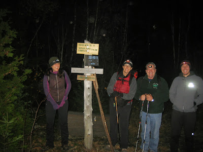
The plan for this HMW adventure was to go southbound for a number of reasons, the most significant being the fear of getting lost in the northern parts of the trail at night as I had never been on that part before.  So it was a Friday night campsite by Abol Bridge in the shadows of the magnificent Mount Katahdin.
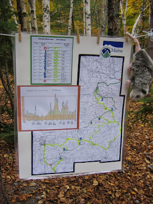


The "game plan".

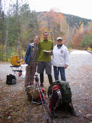
After a bountiful feast and a restful night tenting on the banks of the West Branch Penobscot River, I was raring to go the next morning at 6:30 with just enough light to ditch the headlamp.  Pacer extraordinaire Brian "Al Wesir" Stefanovic would join me from the start.  I was lucky to discover that Brian had just relocated from Fort Collins to Boston and he jumped at the chance to escape the city life for the Maine wilderness for the weekend.
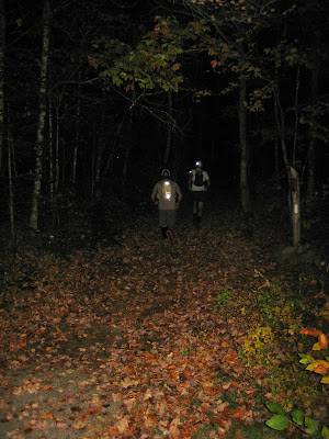


Off we go!

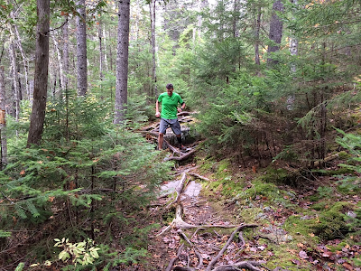
Going southbound, I knew the real mountains would come in the second 50 miles (and in the dark).  Therefore, I was hoping to cover the first 50 at a decent, yet comfortable, clip.  Brian quickly referred to the trail as the "Rainbow Tunnel" and it was just a perfect morning to be out doing what we both love.


Brian atop the Rainbow Ledges.

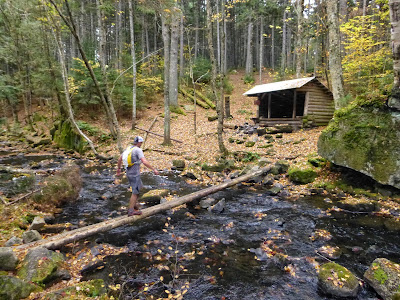
Balancing act to the Rainbow Stream Lean-to.

These early miles had us skirting numerous ponds and lakes,

One Maine loon in no rush to head south on this day.

 with some wonderfully runnable trails,


with some not-so-runnable trails,


and plenty of "bog logs".


Shortly after leaving Pollywog Stream (Mile 17), our first aid stop (and right on the projected time), I realized that Brian was falling off the pace.  Unfortunately, I wouldn't see Brian again until Jo Mary Road (Aid #3 at Mile 41).  I think he decided that the pit crew was just having too much fun so he joined them at Nahmakanta Lake.  I was still feeling great and was very hungry (a good sign for my stomach).  I think I impressed my crew most by my ability to down a cup of venison stew, a whoopie pie, a Coke, and a Sam Adams in less than 2 minutes.


Brian leaves me for some high stakes cribbage with Uncle Pine.

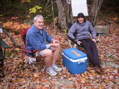
Fueling up at Jo Mary Road crossing.

Darkness came early with the 6pm sunset.  I was able to catch some beautiful views from atop of Little Boardman Mountain, my most significant climb thus far, as the sun was going down.  I arrived at West Branch Ponds Road (Mile 55) in total darkness at 7pm (right on my projected time), just 12.5 hours after leaving Abol.

Staring at Little Boardman from Crawford Pond.

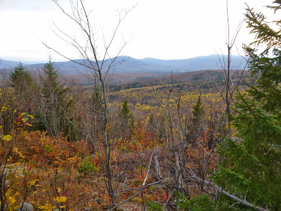
View from on top of Little Boardman.

I took my longest break of 16 minutes here at this road crossing getting a good meal into me as I prepared for my longest stretch without aid.  The next 15-mile section would take me over Whitecap (the tallest mountain in the HMW), Hay, West, and Gulf Hagas mountains before the long descent to the Pleasant River.  I expected to see my crew again about 5 hours later at the KI road crossing (just a few miles from Camp Pine).  I left actually looking forward to the mountain climbs and some extended hiking.

Topping out Whitecap above the treeline in the dark was certainly a highlight.  It was still overcast so not too many stars, but I was surprisingly comfortable in a t-shirt.  The only thing that spoiled my summit experience was taking a swig of Brian's Kona Mocha EFS from my (his) gel flask when I was expecting lemon-lime VFuel.  I nearly barfed right there.  No biggie except that I realized I had nothing but water now to get me through the next 4 hours.

Whitecap Summit.

The next 11 miles to the Pleasant River were a grind.  Even though it was all downhill after summiting Gulf Hagas Mountain, it was just too technical to ever find any kind of running rhythm.  The same really could be said for the whole remaining 40 miles.  The KI road just on the other side of the river was a mini-milestone for me though as it was close to "home" (Camp Pine) and meant just 30 miles to go.  Finally I could hear the river flowing and got on to some smooth runnable trail, boosting me into my fastest running pace all day.  Following the beam of my headlamp, a strange dark shadow kept appearing out of the corner of my eye.  I finally look to my left and a bear cub is matching me stride for stride.  I instantly thought "oh shit, where is your mama?".  Luckily I hit the banks of the Pleasant River seeing the lights of my crew on the other side.  I somehow made it across without taking a swim and was stoked to have made it to KI (Mile 70) a little after midnight.


The crew is ready and waiting at KI with just what I need.

Only 30 miles to go?  No problem!  Yeah right, I was already familiar with what lied ahead and was fully expecting another 12 hours to get this thing done.  The Chairback-Barren range is the most challenging stretch of the HMW.  I was encouraged by the fact that part of my amazing crew was planning to hike in a side trail and meet me in the middle of the night somewhere between Third and Fourth Mountains.


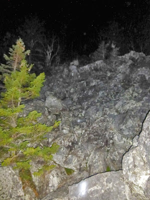
The Chairback "Slide"

Glad to see the crew still having fun at 3 in the morning.

By this point I wasn't sure which summits I had topped and which ones I had not.  There are many ledge-cropped summits through this range and I wasn't sure if I had come over Third Mountain yet when I saw a headlamp approaching.  It was great to be met by Brian who let me know we had just a little over a mile to the trail junction and the rest of the crew.  Now the stars were out and despite my fading condition I couldn't help but appreciate the fact that I was in such a wonderful place with wonderful people doing something really cool.

I met up with the rest of the crew and laid on the ground for a few minutes.  My sister Regina, aka "Whispering Pine" would be joining me for the rest of the night.  An AT thru-hiker herself and the one who has spent more time hiking these trails than anyone I know, she was ready to get me over Fourth and Barren Mountains and through the remainder of this relentless mountain range.  Hopefully, my energy would be renewed by morning as we would be meeting up with Ma and Pa Pine at Long Pond Stream, my next aid station.  I definitely went through my lowest point through here, swearing at every rock and root and hoping not too fall and break my neck on the crazy steep descents.  As expected though, when the skies lightened up so did my spirits and we were greeted with amazing views atop the Barren Ledges.


Barren Ledges.


Long Pond Stream.

With the Chairback-Barren Range in the rearview mirror, my energy coming back, and just 14 miles to go, I am ready to push this thing to the finish.  I want to run, however the HMW just never cooperates.  If there was a section I underestimated it was this stretch from Long Pond Stream to Little Wilson Stream.  Three more hours to cover this measly 7 miles?  It was great to see my first thru-hikers of this new day, a fun group at the Wilson Valley Lean-to.  They about flipped out when I told them what I was up to and that I had left Abol Bridge just yesterday morning.  They flipped out even more when I emptied my pack of all the snicker bars I was carrying.  I left to loud cheers from this grateful bunch, just the boost I needed.

My last aid stop, another hike-in aid by my amazing crew, came by Little Wilson Falls with 7 miles to go.  I'm now thinking a lot about doing this thing faster than anyone has been known to do it, the "Fastest Known Time".  It's 10:30am, I am 28 hours into this, and I have just about 2.5 hours to get the FKT.  I probably wanted it even more now for my support crew than I wanted it for myself.  They worked so hard for me.  So I threw off my pack, grabbed a can of Sprite and an apple and barely stopped here as I knew time was becoming critical.

Hoping this final section would at least be a little easier than the previous 7 miles, I longed for just a half-mile of runnable trail (or a quarter-mile, or a tenth of a mile).  But as expected, the HMW stayed relentless all the way to the end.  I am able to run a few pretty good stretches, enough to make me confident I am going to cover this section faster and that the FKT is going to happen.  I finally hear the sound of traffic and shortly after I am met by Brian who lets me know there is just 0.4 miles to go!  I hit the pavement of Route 15, completing my journey in 30 hours 22 minutes and 5 seconds, a mere 26 minutes faster than Ryan Welts and Adam Wilcox did it in 2011.

Bringing it home!


Mission accomplished.


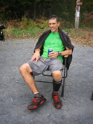
This Hundred Mile Wilderness adventure will be something I will treasure forever.  My family and friends obviously went above and beyond even the high expectations I already had, just because that's how they do things around here.  I can guarantee that no one has ever received the support I had over the course of the HMW before.  I am so lucky for the experiences trail running has brought me, and loved sharing this one with my Maine family.

-Brother Pine


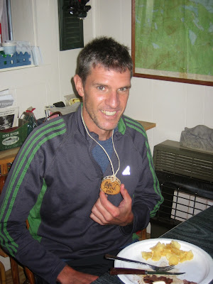
Even a custom finisher medal!


The data (mileages based on AT Data Book)

Start: Turn off the Golden Road pavement just west of Abol Bridge (10/12/13 6:30:00am)

Aid #1 (Mile 17.4): Pollywog Stream (Arrive 9:58am, Depart 10:04pm)

Aid #2 (Mile 25.7): South end of Nahmakanta Lake (Arrive 11:55am, Depart 12:02pm)

Aid #3 (Mile 40.9): Jo Mary Road, Cooper Pond (Arrive 3:21pm, Depart 3:29pm)

Aid #4 (Mile 47.8): Kokadjo-Johnson Pond Road (Arrive 4:57pm, Depart 5:00pm)

Aid #5 (Mile 54.7): West Branch Ponds Road/B Pond Road (Arrive 7:00pm, Depart 7:16pm)

Aid #6 (Mile 69.5): KI Road (Arrive 12:12am, Depart 12:25am)

Aid #7 (Mile 76.4): Third Mountain Trail Junction (Arrive 3:30am, Depart 3:37am)

Aid #8 (Mile 85.3): Long Pond Stream (Arrive 7:33am, Depart 7:35am)

Aid #9 (Mile 92.6): Little Wilson Stream (Arrive 10:26am, Depart 10:27am)

Finish (Mile 99.4): Edge of pavement Maine Route 15 just north of Monson (10/13/13 12:52:05pm)

Total Time: 30:22:05

GPS data:

Track 1: Abol Bridge to KI Road click here
               66.95 miles, 10013ft gain, 9856ft loss

Track 2: KI Road to Route 15 click here
               28.07 miles, 7038ft gain, 6567ft loss

Total: 95.02 miles, 17051ft gain, 16423ft loss

Monday, October 14, 2013

30:22:05


The pain of the endless rocks and roots should only linger a few days, but the memories of this spectacular weekend on the 100 Mile Wilderness will last forever!  More details to come.

Thursday, October 10, 2013

Back to the Wilderness


Date: October 12

Time: 6:30ish AM (EDT)

Where: Hundred Mile Wilderness of the Appalachian Trail, Maine

Start: Abol Bridge

Finish: Route 15 (4 miles north of Monson)

Pacers: The Wesir, Whispering Pine

Crew: A clan of Maine-iacs who know their way around this trail better than anyone

This "run" has been several years in the making.  An idea that surfaced the last time I stepped foot on this section of trail where I grew up.  That was 2007, the year I got hooked on trail running and the last year I owned a pair of road shoes.  Fresh off my first Pikes Peak Marathon that summer, I tackled 17 miles of the Wilderness through the rugged Chairback Range.  It "only" took me five hours and still remains one of my favorite trail running memories.

In 2007, I did not know of anyone taking on the Wilderness in one non-stop push.  It has just been over the past few years that the local media reported it being done in such a manner.  In 2011, Ryan and Adam from New Hampshire completed it in 30 hours and 48 minutes, the current FKT (fastest known time).  Adam posted a nice report here.  His advice to me, "do not underestimate this".  Isn't that what the sign says?

I'll be wearing a friend's SPOT tracker, so you can follow the fun here.


Highest point of the 100-mile Wilderness (Whitecap Mt. with Ma Pine and Uncle Pine)

Thursday, July 25, 2013

Hardrock 2013


Approaching the top of Handies Peak some 14,000 feet above sea level and around 35 miles into Hardrock, I hear Mikio's heavy breathing resembling a dying vacuum cleaner.

Rob: "Mikio...you...okay?"

Mikio: "Can't...breathe...need...oxygen...."  "Wooo...Hooo!!!!"

Mikio Miyazoe, from the Pacific shores of Japan, 16th place in 32:50!

I came into this year's Hardrock feeling as physically ready as I could possibly be.  I knew from experience, however, that Hardrock is just as much a mental challenge as it is physical.  So I told myself that from the start, and until I kissed that sacred Rock, I was going to have fun.  Just like my comrade Mikio.

This race report won't even attempt any "play-by-play" reenactment of my 35 hours out there in the rugged San Juan Mountains.  You climb.  You hurt.  You feel like crap.  You descend.  You hurt.  You, hopefully, feel a little less like crap.  You repeat this many, many times and just hope everthing holds together long enough to get you back to Silverton.  And all the while you soak in the amazing scenery, cherish every second of it, and share the experience with your best friends.  At least that's how I did it.


It's the middle of the night somewhere between Governer's Basin and Virginius Pass, home of the best aid station anywhere (Kroger's Canteen).  It's cold.  It's raining.  Completely sapped of any energy, every upward step is a challenge.

Rob:  "Hey Mike!  Okay if I sit on this rock?"

Mike: "No."

Rob: "I promise to eat 5 M&M's."

(my pacer Mike was gracious enough to grab me a handful of M&M's from Governer's aid after I deposited my meal on the side of the trail just a few steps after leaving)

Mike: "Can you make it 10?"

Rob (stomach churning):  "I don't think so.  How many M&M's you think it'll take to get me to Kroger's?  I need a shot of tequila."

 
Let's stay a while Mike.  And don't eat all of Victoria's grilled cheese sandwiches.

Aid stations, aid stations, aid stations!  So a little over 3 hours spent at aid stations this time.  I've already decided for the next 100 I'm not stopping at aid stations, period!  My stomach went bad shortly before Grouse Gulch (mile 40) and just never accepted much of anything after that.  I was hoping that sitting a while at the low altitude aid stations might turn it around, but it really just turned out to be a waste of time.  Thoughts of my stomach issues keeping me from finishing this thing?  Never!  Did my sour stomach take away from the "fun" I was having?  Not one bit!


It's Saturday afternoon (as far as I can tell since I didn't where a watch), and the taste of the single Pringle chip I ate at Putnam aid station (mile 95) still lingers in my mouth.  Somehow this chip has calmed my stomach pain and nourished my entire body.  A hard rain starts to fall and cools my sunburned skin.  I turn to my pacer Kristel with a big smile on my face.

Rob:  "Hey Kristel!  Are you ready to finally do some running?  And you better run fast or I might drop you."

Kristel: "Yeah right.  I don't think so!"


Those few miles from Putnam aid to Mineral Creek will always be among the most memorable miles of trail I have ever run.  I knew that within an hour I would be welcomed to the special family of Hardrock finishers and I was literally running as fast as I could.  I just had too much respect for the course and the event that giving it anything less just wouldn't feel right.  We hit the banks of Mineral Creek (no I couldn't drop Kristel despite trying my best) and I suggested that we might want to slow down just enough so I don't throw up on the rock before kissing it.  I was never so happy to see Silverton, Colorado again!


35:01:30!  25th place!

I couldn't be any more satisfied with this one.  I had the two best pacers in the world with Mike and Kristel and I can't wait until they both get their chance to crush this course some day!  I had a great crew with my sister Regina, Uncle Sam, and my good friend Kevin.  Sam's first visit to Colorado!  Such a fun battle with JT out there from the time he found me wandering aimlessly between Pole Creek and Sherman until I last saw him cresting Grant-Swamp Pass some 70 miles later.  Great race JT and congrats on the PR and #5!


What are these two guys doing in the top 20?

Fort Collins was well represented down in Silverton, as always, and thanks so much to all my friends down there!  It was great to represent the Fort with Pete, who had an amazing race given his no training and 48 hour pacing plan (38 hours and 40th place!).  Also congrats to our Fort Collins neighbor Alan and thank you for the custom lemon-lime VFuel.  Tiny sips of that on Saturday were about all the fueling I was getting.

Team Fort Collins at the starting line.

So once again, I leave this Hardrock feeling like I got the experience of about five 100 milers in one shot.  I honestly can't wait for the next 100-mile adventure (a trek through some Wilderness I still like to call home).  And, as for Hardrock, I hope to get another shot as soon as they will have me back!  I've been asked if I thought I could have done this one any faster (I did spend a lot of time at aid stations) but the answer is definitely NO.  Having fun out there (maybe too much fun at times) was what kept me going.  This isn't a course to be "raced", this is a course to be "experienced".  I can't wait for my next experience at Hardrock!  Whether it is "racing", pacing, crewing, or volunteering, I will always be drawn to the beautiful San Juans and the great town of Silverton come July every year.

Team effort!

Monday, July 15, 2013

Kissing the Rock!


Hardrock 2013:  35 hours, 1 minute, 30 seconds  (25th place)

A race report for Hardrock may be more difficult than the run itself (not really).  Far too many stories, pictures, and unforgettable experiences than I'll ever be able to sum up in a blog post.  Maybe some words will come, but for now I'll just say it feels pretty damn good to know I'm a Hardrock FINISHER!


Sunday, July 7, 2013

Summer in the Never Summers


It is clearly obvious now that I have spent WAY too little time in the Never Summer Range which runs from Cameron Pass down through the northwest corner of RMNP.  Starting at Lake Agnes (actually the Lake Agnes trailhead a mile below) with Nick and Mike, we had no clear objective for the day.  Just an "easy" day in the mountains for 2 guys "recovering" from some big mountain races less than a week ago, and one "tapering" for quite the mountain adventure in less than a week.  It turned out that Mahler and Richthofen (shown above, Mahler on the right) would call us out.


Just getting started from the shores of Lake Agnes.

A trail shown on the map indicated a possible route out of Agnes gaining the ridgeline northwest of Mahler.  That trail never really showed up until we reached the ridgeline and a climb up the Agnes inlet drainage worked the best.  This route led us by two picturesque high mountain lakes, waterfalls, and enough wildflowers to induce multiple spontaneous outbursts of "Sound of Music" tunes.  The summit of Mahler came quickly from there.

The view back toward the Nokhu Crags as we climb out of Agnes.

Wildflowers in full bloom.

The map was out early and often.
 
A trail and some running greet us on top of the ridge.

The line to Richthofen from the 12,493 foot summit of Mahler consisted of a narrow crumbly ridge and did not look too inviting.  We took it as far as we were all comfortable, but then decided to bail and opted for a long scree ski down into the magnificent basin to the south.  From there it would be a longer, but more solid climb up to the 12,951 foot summit of Mount Richthofen, the highest point in the Never Summers.


The line from Mahler to Richthofen.


One of a few routes on the day that just didn't "go" for this crew.


Our escape route off the ridge.

Climbing again.
 
View down to Lake Agnes from atop Richthofen.
Static Peak would be next in line as we would circle the Lake Agnes basin, but the consensus was that we had enough for the day and, according to the topo map, a descent back to Agnes from the Richthofen/Static saddle should be doable.  So we pushed forward.  Little did we know that we were not done with Richthofen.

Descending Richthofen with Static Peak looming.
We resisted the urge to tack on Static and started the nasty, crumbly descent back down to Agnes from the saddle.  Unfortunately, a significant cliff band would block any and all paths we tried to get down.  Seems as though we are a lot better at climbing mountains than getting off them.  So a "Double Richthofen" it was, since we were quite sure of a route back to Agnes from the Richthofen/Mahler saddle.  Back over the summit of the "Baron" (Baron Ferdinand von Richthofen) and finally we did make our way back to Lake Agnes, or as Mike was now calling "Leg Acheness".

Almost back to Agnes, but we would be denied on this route.

Much, much more to be climbed and seen in the Never Summers.  A full traverse from Baker to the Nokhu Crags?  Good luck.