Friday, December 31, 2010

2010 Summary


Since I've got the numbers, I thought I would share them.  Total miles ended up at 2281 with approximately 65 miles of climbing.  The breakdown:

1274 trail miles (48 miles climbed, 281 hours)
190 treadmill miles (14 miles climbed)
97 track miles (no climbing)
720 road miles (estimated 3 miles climbing)
129 resistance workouts (weights/plyometrics, about 100 hours)

Prominent Summits:


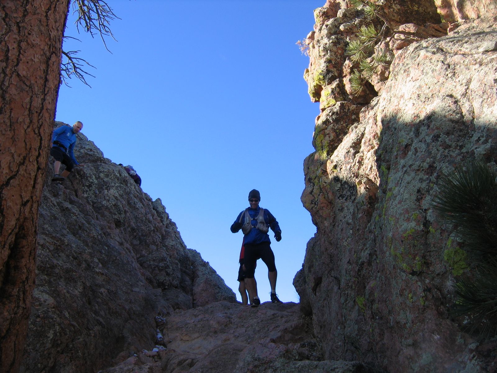
Longs Peak (14,255ft)
Comanche Peak (12,690ft)
Signal Mountain, 3 times (11,253ft)
Lookout Mountain (10,597ft)
West White Pine Mountain (10,302ft)
Crosier Mountain, 3 times one day (9216ft)
Sheep (Round) Mountain (8458ft)
Horsetooth Rock, 7 times (7208ft)
Arthurs Rock, 3 times (6772ft)

I ended up my year today with 15 miles of urban trail (road) around Fort Collins in the snow and single digits (welcome Winter).  I'm really happy with the total numbers.  As I pointed out in a previous post, my miles are pretty low compared to a lot of my trail running peers.  Of course since that post a month ago I went out and did 270 miles in December (my biggest month).  As all trail runners know, however, all miles are not created equal.  Pete recently posted his 100th vertical mile of 2010 and that is a number that I put more value to than horizontal miles.  Maybe I will shoot for 100 in 2011, but it will be tough.  I'm going to have to convert more of those road miles to trail miles but that is not always feasible.  I am trying to make an effort to do more short trail runs at harder efforts.  For example, I plan to make the Horsetooth Summit time trial a regular personal challenge.

It's been a great year of discovering new trails and I hope to continue that trend in 2011.  I will assume Hard Rock to be my goal race this summer until I hear otherwise from the February 5 lottery.  There is also a long list of runs and adventures that don't involve a registration fee or racing bib that I hope to slowly make my way through.  As a kid, my Dad and I used to joke how we wanted to fish every pond and lake in Maine.  Impossible!  Now I feel the same way about trying to explore every trail in Colorado.

I am thankful to go another year injury-free (not counting the everyday muscle soreness of this 40 year old body).  I think the resistance training is key to this.  I am also lucky to have the support of a wonderful wife and two girls who let Dad disappear into the mountains for hours on end and then lets his stinky, sweaty body back in the house upon his return.

2010, you are done!

Wednesday, December 29, 2010

Anti-minimalist shoe

I took another shot at a sub 30 minute Horsetooth summit today, the result a 31:05.  This was a new PR, but I still know I can do better.  I tried to chase "Proud Daddy" Clark up the hill today and maybe went out a little too fast (10:14 split at mile 1).  Anyway, Nick lowered the standard today with a smokin' 23:50 (details here).  On our return loop through the park, Nick commented on my shoes and how I probably could shave a good minute with something more lightweight.  The North Face Ultra 106 Goretex (shown above) were a great shoe for me last winter (actually the 104's last year) as I trudged through snow-covered trails for several months.  So I got a new pair for this winter, but haven't really needed them yet (I prefer the Brooks Cascadias).  No doubt these shoes are monsters, so I decided to weigh my shoes this afternoon and found my size 13 Ultras to be a whopping 20.8 ounces per shoe.  Not a complete dry weight with a little sweat still on them, but still heavier than I thought.  I figure if I run through the winter in these boots I'll have the leg strength to fly over the San Juan mountains come July 8.  However, next time I go for a Horsetooth summit PR in dry conditions like today, I'll probably throw on my beat up Cascadias (size 12.5, 14.7 ounces).

After today's run, I realized that December will actually be my highest mileage month of the year.  I guess the increased opportunity to get out on the trails this month combined with the fact that these trails could be buried in snow any day (like tomorrow) has motivated me to rack up some trail miles.

Today's run:
Horsetooth Rock Trail (with Southridge shortcut near top): 2.34 miles to summit (31:05)
Return via Wathen, Spring Creek, Horsetooth Falls
7.32 miles total with 1813 feet vertical (GPS data here)

Monday, December 20, 2010

Lory Rescue Mission

I was out on the trails of Lory State Park today and came upon this deer lying down on the Howard Trail.  I could have sworn it was mumbling something that sounded like "damn Chubby Cheeks course".  So I asked the deer if he was a member of team CRUD.  But honestly, the poor animal couldn't get up.  Division of Wildlife had already been informed by the time I could let them know.  No other carnage was found on the CC course.  It's been fun reading the various reports and seeing the pictures from all the great people that turned out on Saturday.
Today's rather scattered 17 miles (2824 feet of vertical) can be viewed here.

Saturday, December 18, 2010

Chubby Cheeks 50K (6:26:36)


Well the long-awaited event finally arrived and it certainly didn't dissapoint.  I evened up my score with this course with a pretty strong run today, but more importantly got to spend some time on the trails with some old and new friends.  I don't know if Horsetooth and Lory Parks has ever had this many accomplished trail runners out on the trails all at one time before.  We had near perfect trail conditions on a nice crisp December day.  Big thanks to Nick for hosting the first (we hope of many) Chubby Cheeks (aka El Chubbo Grande, Chubster, Chubbapalooza, ...) Fort Collins Fat-Ass.

Some more pictures from the day can be seen here

GPS data here

Garmin had the 50K course at 31.36 miles with 6858 feet of climbing.

Pete Stevenson tearing up the course today.

No shortage of climbing.

Thursday, December 16, 2010

Chubby Cheeks Teaser


I'll let the picture describe the current course conditions.  Barely any snow up here in Fort Collins and another beautiful day on the trails.  The CC course is just about prepped for the big event.

Sunday, December 12, 2010

FoCo R2R2R


Sunrise from Horsetooth Rock (summit 1)
 I was looking for about 4 hours today on the Horsetooth and Lory trails with a good amount of climbing.  What I ended up doing was a first for me.  I'll call it Fort Collins' version of R2R2R (Horsetooth Rock to Arthurs Rock to Horsetooth Rock).  I didn't take the most direct route in either direction and instead made a nice loop of it.  I usually don't even bother to tag these summits, but I have kind of been on a summit tagging binge lately.  Just under 20 miles for the day and just over 5000 feet of climbing.  Trail conditions are perfect right now for El Chubbo.

Today's Course:
Southridge-Audra Culver-Horsetooth Rock (to summit)-Westridge-Towers-Mill Creek-Howard-Arthurs Rock (to summit)-Valley-Sawmill-Loggers-Herrington-Spring Creek-Wathen-Horsetooth Rock (to summit)-Southridge.

Start/Finish at Horsetooth Mountain Trailhead.

GPS data here

Horsetooth Rock as viewed from Arthurs Rock (summit 2)

Arthurs Rock in the distant as viewed from Horsetooth Rock (summit 3)


Saturday, December 4, 2010

2000 Miles


While many trail and ultrarunners are posting double the mileage that I am, I actually take a little pride in being able to participate and compete (faster than some) in this sport on just 2000 miles in 11 months. I hit mile 2000 on November 29. I attribute this to quality over quantity and to cross-training. That being said, I am continually trying to tweak some things to get better. I am now trying to work in some more hard efforts on the trail at shorter distances. Like a few days ago, I made another attempt for a Horsetooth Summit PR using a slight course change (little bit longer, but maybe faster?) based on Nick's suggestion. The result was 33 minutes flat (a little over a minute slower than my last attempt). The thought was that by using more service road and less singletrack, the climbing pace could be upped a little. However, I actually feel like a better climber on the singletrack. I'll make many more attempts using all of the different course options so I'll eventually figure it out.

Big race outside of San Francisco this morning with $10,000 up for grabs at The North Face Endurance Challenge 50-miler. A strong international presence at this one as Spain's Miguel Heras won for the men in 6:47 and New Zealand's Anna Frost took 1st woman in 7:45. Congrats to new Fort Collins resident Dakota Jones who took 4th place with a 7:02. See what these Fort Collins trails can do for you, and he's just 19 years old!

Today's run:
9.2 miles, 2477 feet climbing

Horsetooth Rock/Southridge/Horsetooth Rock (summit in 33:00)/Westridge/Spring Creek/Wathen/Horsetooth Rock.

Start/Finish at Horsetooth Mountain Trailhead.

GPS data here.

A frosty morning on the mountain.

Sunday, November 28, 2010

Horsetooth Rock Summit PR


With a little bit of daylight left this afternoon I decided to put in a good short, but hard workout on the trails. I have never tried to see how fast I could summit Horsetooth Rock, so I knew today would be a PR. I have gotten up there several times around the 35 minute range at the start of longer runs and not by way of the shortest and fastest route (which is still debatable). I was hoping for a sub 30 minute, but instead touched the high point of the north summit at 31:56. I felt like I was really dragging from the start, so I will take it as a good workout and keep that sub 30 as motivation to try again. Nick's 25:26 FKT is safe from me.

My route:
Horsetooth Rock (singletrack from trailhead)/Service Road (where Horsetooth Rock and Southridge trails merge)/Horsetooth Rock singletrack/a bit of Southridge service road near top/Horsetooth Rock to north summit

At 2.34 miles, I think this is the shortest route. However, I think it might be a bit quicker to start going up the Southridge service road from the trailhead instead of the singletrack. I'm quite sure my split at the bench (where Horsetooth Rock and Southridge trails merge) was slower than I have run when going Southridge from the start.

I completed the run by descending the Wathen trail and looping around Spring Creek and Horsetooth Falls back to the trailhead for a total of 6 miles. The park was very peaceful with some light snow flurries breaking out as the sun was setting. A nice way to spend an hour.

GPS data here

Saturday, November 27, 2010

Montgomery Pass Trail


Snow, snow, and more snow up around Cameron Pass. Made for some great snowshoeing up the Montgomery Pass Trail and even better sledding back down. Beautiful day with Madison, even if she did ditch the snowshoes half way up to the pass and made Dad pull her the rest of the way on the sled.


The downhill was much more fun.

Friday, November 26, 2010

Weekday Double-Dip


Most weeks my trail runs come on the weekend and any time I get on the trail during the week is a bonus. With the Thanksgiving holiday, I was able to get out twice (Thursday Coyote Ridge and Friday Foothills Trail). Two fairly short and very accessible runs from Fort Collins. I pushed the pace a little more on Thursday than I did this morning, but in all a good training week.

Coyote Ridge/Indian Summer:
10.6 miles
1685 feet climb
Start/Finish at Coyote Ridge Trailhead
GPS data here

Foothills Trail/Reservoir Ridge:
13 miles
2185 feet climb
Start/Finish at Maxwell Natural Area Trailhead (behind football stadium)
GPS data here

Sunday, November 21, 2010

Coyote Ridge/Devil's Backbone


I can't believe it's been since August that I have run out of Coyote Ridge. I usually run from this trailhead quite frequently, being the closest trailhead to my home. I opted for some snow and ice free trails today with an out and back from Coyote Ridge Trailhead to Devil's Backbone Trailhead. This included all the trail spurs (Indian Summer, Lauging Horse, Hunter, etc.), which I took in a counter-clockwise direction today. I felt really good and ran one of my faster times for this run. Good confidence booster after a rough go on the Chubby Cheeks course the other day. I probably saw close to 100 mule deer this morning.

Today's run:
19.7 miles and 2659ft climb

GPS data here

Tuesday, November 16, 2010

Chubby Cheeks Course 1 Yonder Mt Runner 0

I took on the Chubby Cheeks 50K course today that Nick has designed for the 12/18 Fort Collins fat-ass. I was hoping to provide some stats and a GPS track for those out-of-towners who may want to upload some data to their navigation devices. Of course, Nick will probably add a time penalty if you run with a navigation device. Well if you do upload the GPS track, only follow it for the first 23.5 miles. The course was pretty much mine for the first 19 miles. Both summits (Horsetooth and Arthurs Rock) down and going strong. The section of Well Gulch and Overlook (Miles 19 to 21) landed a few jabs on me as it normally does with a lot of miles in my legs. The knockout punch came going up Sawmill around Mile 23. Not just the climb, but the sideways rain/snow and a good 20 degree drop in air temperature in a matter of minutes. I was not prepared for that as I was underdressed and packed pretty lightly on what was a very pleasant morning. I started having flashbacks of Bighorn and hypothermia. So I made a left turn at the Loggers/Sawmill junction (about Mile 23.5), instead of the right turn and eventually climb back up toward Horsetooth Rock that the course takes, and I drug my beaten and frozen self back the shortest route I knew to the trailhead.

Today's route:
Horsetooth Rock-Southridge-Audra Culver-Horsetooth Rock to North Summit-Horsetooth Rock-Soderberg-Spring Creek-Stout-Herrington-Spring Creek-Mill Creek-Howard-Arthurs Rock to Summit-Timber-Valley-Well Gulch-Overlook-Arthurs Rock-Valley-Sawmill-Loggers-Towers-Herrington-Spring Creek-Soderberg-Horsetooth Rock-Southridge

Start/Finish at Horsetooth Mountain Trailhead.

GPS Data here

According to Garmin
Distance 26.8 miles
Climbing 6115 feet

I figure I cut out about 1000 feet of climbing (and about 3 miles) with my shortcut near the end, and if you add the 600 foot climb back to Nick's house, this course should be in the 7500 to 8000 foot range. Nick, you've created a monster. Next time she is mine.

Monday, November 15, 2010

Crisp Sunday Morning


It's been great exploring lots of trails around the Northern Front Range this Summer and Fall, but with the change in the season (the snow season), most of my trail runs now will be back on the familiar Horsetooth/Lory/Blue Sky network. That's not a bad thing. With so many different loop options, just about every run is a new one. I will also spend less time in the car driving to a trailhead and more time on the trails. The trail conditions were still really good for running despite the snow. A lot of bare ground on the South-facing slopes, very few icy spots, and the snow got no deeper than the ankles in a few spots where I was breaking trail.

Today's run (16-miles):
Swan Johnson-Shoreline-Valley-Arthurs Rock-Overlook-Well Gulch-Timber-Westridge-Howard-Mill Creek-Loggers-Carey Springs-Towers-Herrington-Loggers-Sawmill-Nomad-Towers-Swan Johnson

Start/Finish at Soderberg Trailhead.

GPS data here


View to the West from Lory's Westridge Trail

Thursday, November 11, 2010

First Snow


The extended summer in Fort Collins came to an abrupt end. Time to break out the Goretex shoes and snow gaiters. There was really less snow on the trails than I expected. I wouldn't even categorize today's run as a trudge as the snow didn't even overtop the shoes for the most part. It probably won't be long though until it is back to this.


Today's 12-mile run around the snow-covered Horsetooth Mountain Park:

Horsetooth Falls/Spring Creek/Herrington/Stout/Sawmill/Loggers/Mill Creek/Towers/Westridge/Horsetooth Rock

Start/Finish at the Horsetooth Mountain Trailhead.

GPS data here

Tuesday, November 9, 2010

Lookout Mountain


I did some serious vertical this week for some more scouting of potential trail race routes. Almost all of the trails I ran today were for the first time. About a 3000 foot climb up from Miller Fork to Donner Pass and the summit of Lookout Mountain (10626 ft), although I did inadvertently summit the wrong peak just East of Lookout Mountain first. I then dropped down about 2000 feet to scout some trails around Crystal Mountain. I didn't summit Crystal today, but by the time I climbed back over Donner Pass I was kind of glad I didn't. I was unsuccessful in finding a different return (Indian Trail) back to Miller Fork so I came back the same Donner Pass Trail. Still need to do some more scouting but that makes a good excuse to come back. It looks like the virtually snow-free trails I ran today will not be that way after this week.

On another note, registration just opened for Hard Rock next July. That is the goal race for next year if I am able to get my name drawn.

Today's run (and hike):
17 miles with 4900 feet of climbing

GPS data here

More photos here


Dawn's early light over Longs Peak, Meeker, and the Twin Sisters

Lookout Mountain as viewed from unnamed peak East of Lookout


East and West White Pine Mountains to the North of Lookout

Crystal Mountain to the East of Lookout

Signal Mountains and the Mummy Range to the West of Lookout

Monday, November 1, 2010

Soapstone and Red Mountain


Last summer over 50 miles of trails were opened to the public in the Soapstone Prairie Natural Area and Red Mountain Open Space. Trail maps and info can be found here. With quite a bit of snow in the mountains now and hearing of Alex and others making the trip out here last weekend, I decided it was finally time to check some of these trails out. I wasn't disappointed. While a lot smoother track and a bit milder climbing than I am used to, it was nice to actually rack up some big miles at a pretty steady pace. I wish I had my GPS to see what the total climbing was because I'm sure it added up, but the trail maps show the route that I ran today as 26 miles. I'm guessing around 2500 feet of climbing and my legs were definitely feeling it near the end. I'm sure these trails can get quite hot in the summer as there is no cover, and this is good rattlesnake country. All the more reason to run it this late in the year, although I still came upon one rattler today (in November?). It's unfortunate that these trails are closed from December through February. My route for today took me in a lolipop pattern starting and ending at the Cheyenne Rim Trailhead at the south parking lot just past the Soapstone entrance station. I ran the entire length of Cheyenne Rim Trail (across the Wyoming border), then back down Ruby Wash, around Bent Rock, past Red Mountain Trailhead, up Sinking Sun and Big Hole Wash, where I reconnected to Cheyenne Rim and ran back to the trailhead. Really just the western part of Soapstone and most of Red Mountain. Lots of interesting geology and plenty of wildlife, but hardly any people today. Just 2 hikers who took off from the Red Mountain trailhead. I don't know if I will get back out here this year as I still prefer the forests and the mountains, but this is a great system of trails that are pretty convenient to get to from Fort Collins.


Spectacular views from the high ridge just east of Red Mountain Open Space


Descending from Cheyenne Rim along the red dirt


Too nice a day for this rattler to hibernate


Nice little canyon provided the only cover when dropping down into Ruby Wash Trail

Indestructible cairns mark the way down Ruby Wash

Bent Rock Trail near Red Mountain Trailhead

Sunday, October 24, 2010

Storm Mountain (More Race Scouting)


So the latest course iteration for the proposed trail ultra event is looking like a 100K (62 mile), with 4 summits, and just under 20,000 feet of climbing. A challenging course for sure. One of these summits is Storm Mountain. This is the lowest of the 4 summits at 9918 feet, but the toughest one to access based on the latest route. The goal is to tie in this summit via a loop from the Dunraven Trailhead/Miller Fork area. The word from the Forest Service seems to be that if we can find existing routes (maintained or unmaintained) then the areas we are now looking at should be ok. The Storm Mountain section will rely on quite a bit of unmaintained trail that hopefully is still in existence. From what I found today, Storm Mountain could still be an option. I definitely found some trail that hasn't seen much use recently, but still a trail by definition. It's going to take at least one more scouting trip up there before deciding to include it. Unfortunately, I didn't get to summit Storm today. Pete and Nick got to the Donner Pass area on Saturday, but had a little trouble finding some trails up there. They had a good excuse since it was all covered in snow. It looks like we might get a lot more snow up there tonight.
More pictures from today's scouting trip here
GPS data here


The high peaks of the National Park covered with snow and clouds.


Monday, October 11, 2010

Flowers Road and White Pine Mountains


I don't usually seek out runs along mainly jeep trail, 4wd road, double-track, or whatever the correct terminology is, but I had no complaints after this run. Starting a few miles west of Stove Prairie on Flowers Road, I ran another 3 miles of this road after it was no longer safely passable for my vehicle. I then headed south and climbed over the pass between East (elev 10248') and West (elev 10305') White Pine Mountains. There was a little over a mile of nice single-track trail to the north of the pass, but otherwise all jeep trail. The scenery was just spectacular and at peak fall foliage. I descended down the south side of the pass to Box Prairie and the trailhead for Donner Pass where I turned around and returned the same route. A total of 16 miles and 4100 feet of climbing. While motivated to run here so I could scout some potential trail racing routes, what I found was an area that I expect I will run many more times in the future.


Signal Mountain (left) spared by yesterday's snowstorm


Flowers Road approach to the mountains to be hurdled

GPS data here

Sunday, October 10, 2010

Fish Creek Trail


We have been pretty much snow-free in the high mountains of the Northern Front Range, and I was hoping to squeeze in another run "up high" this morning, but it wasn't to be. I had planned a nice loop around the Zimmerman Trail and Crown Point starting and ending at Browns Lake Trailhead. As I drove up Crown Point Road early this morning the snow was flying and accumulating. Concerned that I might not be able to drive back down the road later, let alone find my way around on unfamiliar and snow-covered trails, I headed for lower elevations.


Browns Lake Trailhead (elev 10,480') a no-go for today

With so many great trails around Pingree Park, the trip was not wasted and I decided to run the Fish Creek Trail starting from its northeastern trailhead. Its about 6.5 miles one-way mainly between 8000 and 9000 feet in elevation, but still with a few decent climbs mixed in. The other trailhead sits by Sky Ranch. This trail offers a nice mix of dense forest, open meadows, and moderate ridges as it rolls through the Fish Creek drainage. Plenty of beautiful aspen stands this time of year.

On my return for this out and back run I added another little out and back on the Little Beaver Creek Trail and then the connector trail to Flowers Road by Jacks Gulch Campground. My total miles for the day ended up a little over 16 miles (about what I was expecting for my proposed loop up high).
A nice blanket over the Mummy Range

GPS Data for today's run

Sunday, October 3, 2010

Blue Sky Marathon/Half Marathon

Blue Sky Marathoner Bill Moyle still going strong at 71.

The Fort Collins trails played host to about 200 trail runners today for the 3rd running of the Blue Sky Marathon and Half Marathon. While most of the course is out and back along the Blue Sky Trail, the marathon course consists of about a 7-mile loop up in Horsetooth Mountain Park, with a sweet climb up the infamous Towers Road. It was at the top of this climb that I got to hang out with Nick, Alistair, and Crew at the Towers Aid Station and played amatuer photographer (more photos here) while cheering the marathoners through the top of their toughest climb of the day (about 5 miles into the race). Last year, a 50K distance was added in addition to the marathon, but this race was dropped. I think it was wise to stick with just one or the other, instead of having both so similar in distance. Anyway, there is hope for a mountain ultra race in the northern Front Range that could be something special, hopefully next year. Probably either a 50-mile or 100K in and around the Comanche Peaks Wilderness. A proposed 50-mile course can be seen here.

I did get in 16 miles around Horsetooth Mountain Park this morning (about 11 before and 5 after the marathoners came through). Still no snow in the high country and I will try to take advantage of that, if possible, as October rolls on.

The morning course:
Southridge-Audra Culver-Horsetooth Rock-Soderberg-Wathen-Westridge-Towers-Mill Creek-Loggers-Carey Springs-Towers (down to aid station)-back up Towers-Spring Creek-Herrington-Stout-Spring Creek-Horsetooth Falls

Start/Finish at Horsetooth Mountain Trailhead.

Sunday, September 26, 2010

Stromy Peaks Pass to Signal Mountain

The North Fork Big Thompson and the Bulwark Ridge (Signal Mountain) trails out of the Dunraven Trailhead are two trails that I have run many times, but always in out and back fashion. A few weeks ago, I finally hit both of these trails in a single loop. The "big loop" was about 30 miles and took me all the way to Pingree Park. Hoping for a shorter loop option, I decided to explore the unmarked trail that extends from just about a half-mile up the Stormy Peaks Pass Trail from the North Fork Trail (about 2 miles South of the pass) over to Signal Mountain. This trail is shown on old USGS topo maps, but not on any recent trail maps. There are also no signs indicating this trail option.

The start of the trail from the West is easy to find, just take a right at the first mileage sign (7.9 miles to Pingree Park?) near the top of the steep switchbacks heading up toward the pass. The first half a mile of the trail is easy to follow. I lost the trail when it reached a meadow at the headwaters for Pennock Creek. Instead of spending much time looking for the trail, I just headed straight toward Signal Mountain in hopes that the trail would come back to me. I would have been better off trying to maintain the top or close to the top of the ridge, as I dropped down too low toward the valley and got into some rough travelling. I ascended back up the ridge and did find the trail again, only losing it slightly a couple times after that. Luckily, quite a few cairns have been placed along the trail to guide the way. The trail opened up too many great views in all directions along the way, eventually climbing up above treeline on the approach to Signal Mountain. After about 4 miles, I hooked up with the Bulwark Ridge Trail on the saddle between Signal and South Signal Mountains and made my descent back to the Dunraven Trailhead. The total loop is about 17 miles with a just a little under 4000 feet of climbing. I'm sure that I will be back to do this loop many more times (in both directions) and eventually should have little problem following this great connector trail.


GPS data


The view to the West (The Mummy Range)

The view to the South (Longs and Meeker)

The view to the North (Pennock Creek Valley)

Approaching Signal Mountain around the North shoulder of South Signal

Sunday, September 19, 2010

Above the Clouds


It was nice to get a little moisture here over the weekend, but we could still use a lot more. Fort Collins sat in a dense fog for most of the morning while it was clear up in the foothills. Just like last week, I put in about 17 miles and 4000 feet of climbing. This time it was all within Horsetooth Mountain Park. I like to plan routes where I don't retrace (no out and backs) or criss-cross any of my tracks along the way. This was a pretty good one with plenty of climbing.

Today's route:
Southridge-Audra Culver-Horsetooth Mountain-Soderberg-Wathen-Westridge-Towers-Mill Creek-Loggers-Sawmill-Stout-Towers-Spring Creek-Herrington-Stout-Spring Creek-Horsetooth Falls

Start and Finish at Horsetooth Mountain Trailhead.


Reservoir Road Fire outbreak last Sunday