Sunday, November 28, 2010

Horsetooth Rock Summit PR


With a little bit of daylight left this afternoon I decided to put in a good short, but hard workout on the trails. I have never tried to see how fast I could summit Horsetooth Rock, so I knew today would be a PR. I have gotten up there several times around the 35 minute range at the start of longer runs and not by way of the shortest and fastest route (which is still debatable). I was hoping for a sub 30 minute, but instead touched the high point of the north summit at 31:56. I felt like I was really dragging from the start, so I will take it as a good workout and keep that sub 30 as motivation to try again. Nick's 25:26 FKT is safe from me.

My route:
Horsetooth Rock (singletrack from trailhead)/Service Road (where Horsetooth Rock and Southridge trails merge)/Horsetooth Rock singletrack/a bit of Southridge service road near top/Horsetooth Rock to north summit

At 2.34 miles, I think this is the shortest route. However, I think it might be a bit quicker to start going up the Southridge service road from the trailhead instead of the singletrack. I'm quite sure my split at the bench (where Horsetooth Rock and Southridge trails merge) was slower than I have run when going Southridge from the start.

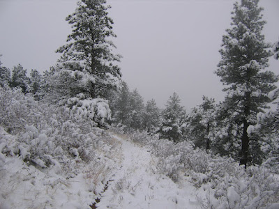
I completed the run by descending the Wathen trail and looping around Spring Creek and Horsetooth Falls back to the trailhead for a total of 6 miles. The park was very peaceful with some light snow flurries breaking out as the sun was setting. A nice way to spend an hour.

GPS data here

Saturday, November 27, 2010

Montgomery Pass Trail


Snow, snow, and more snow up around Cameron Pass. Made for some great snowshoeing up the Montgomery Pass Trail and even better sledding back down. Beautiful day with Madison, even if she did ditch the snowshoes half way up to the pass and made Dad pull her the rest of the way on the sled.


The downhill was much more fun.

Friday, November 26, 2010

Weekday Double-Dip


Most weeks my trail runs come on the weekend and any time I get on the trail during the week is a bonus. With the Thanksgiving holiday, I was able to get out twice (Thursday Coyote Ridge and Friday Foothills Trail). Two fairly short and very accessible runs from Fort Collins. I pushed the pace a little more on Thursday than I did this morning, but in all a good training week.

Coyote Ridge/Indian Summer:
10.6 miles
1685 feet climb
Start/Finish at Coyote Ridge Trailhead
GPS data here

Foothills Trail/Reservoir Ridge:
13 miles
2185 feet climb
Start/Finish at Maxwell Natural Area Trailhead (behind football stadium)
GPS data here

Sunday, November 21, 2010

Coyote Ridge/Devil's Backbone


I can't believe it's been since August that I have run out of Coyote Ridge. I usually run from this trailhead quite frequently, being the closest trailhead to my home. I opted for some snow and ice free trails today with an out and back from Coyote Ridge Trailhead to Devil's Backbone Trailhead. This included all the trail spurs (Indian Summer, Lauging Horse, Hunter, etc.), which I took in a counter-clockwise direction today. I felt really good and ran one of my faster times for this run. Good confidence booster after a rough go on the Chubby Cheeks course the other day. I probably saw close to 100 mule deer this morning.

Today's run:
19.7 miles and 2659ft climb

GPS data here

Tuesday, November 16, 2010

Chubby Cheeks Course 1 Yonder Mt Runner 0

I took on the Chubby Cheeks 50K course today that Nick has designed for the 12/18 Fort Collins fat-ass. I was hoping to provide some stats and a GPS track for those out-of-towners who may want to upload some data to their navigation devices. Of course, Nick will probably add a time penalty if you run with a navigation device. Well if you do upload the GPS track, only follow it for the first 23.5 miles. The course was pretty much mine for the first 19 miles. Both summits (Horsetooth and Arthurs Rock) down and going strong. The section of Well Gulch and Overlook (Miles 19 to 21) landed a few jabs on me as it normally does with a lot of miles in my legs. The knockout punch came going up Sawmill around Mile 23. Not just the climb, but the sideways rain/snow and a good 20 degree drop in air temperature in a matter of minutes. I was not prepared for that as I was underdressed and packed pretty lightly on what was a very pleasant morning. I started having flashbacks of Bighorn and hypothermia. So I made a left turn at the Loggers/Sawmill junction (about Mile 23.5), instead of the right turn and eventually climb back up toward Horsetooth Rock that the course takes, and I drug my beaten and frozen self back the shortest route I knew to the trailhead.

Today's route:
Horsetooth Rock-Southridge-Audra Culver-Horsetooth Rock to North Summit-Horsetooth Rock-Soderberg-Spring Creek-Stout-Herrington-Spring Creek-Mill Creek-Howard-Arthurs Rock to Summit-Timber-Valley-Well Gulch-Overlook-Arthurs Rock-Valley-Sawmill-Loggers-Towers-Herrington-Spring Creek-Soderberg-Horsetooth Rock-Southridge

Start/Finish at Horsetooth Mountain Trailhead.

GPS Data here

According to Garmin
Distance 26.8 miles
Climbing 6115 feet

I figure I cut out about 1000 feet of climbing (and about 3 miles) with my shortcut near the end, and if you add the 600 foot climb back to Nick's house, this course should be in the 7500 to 8000 foot range. Nick, you've created a monster. Next time she is mine.

Monday, November 15, 2010

Crisp Sunday Morning


It's been great exploring lots of trails around the Northern Front Range this Summer and Fall, but with the change in the season (the snow season), most of my trail runs now will be back on the familiar Horsetooth/Lory/Blue Sky network. That's not a bad thing. With so many different loop options, just about every run is a new one. I will also spend less time in the car driving to a trailhead and more time on the trails. The trail conditions were still really good for running despite the snow. A lot of bare ground on the South-facing slopes, very few icy spots, and the snow got no deeper than the ankles in a few spots where I was breaking trail.

Today's run (16-miles):
Swan Johnson-Shoreline-Valley-Arthurs Rock-Overlook-Well Gulch-Timber-Westridge-Howard-Mill Creek-Loggers-Carey Springs-Towers-Herrington-Loggers-Sawmill-Nomad-Towers-Swan Johnson

Start/Finish at Soderberg Trailhead.

GPS data here


View to the West from Lory's Westridge Trail

Thursday, November 11, 2010

First Snow


The extended summer in Fort Collins came to an abrupt end. Time to break out the Goretex shoes and snow gaiters. There was really less snow on the trails than I expected. I wouldn't even categorize today's run as a trudge as the snow didn't even overtop the shoes for the most part. It probably won't be long though until it is back to this.


Today's 12-mile run around the snow-covered Horsetooth Mountain Park:

Horsetooth Falls/Spring Creek/Herrington/Stout/Sawmill/Loggers/Mill Creek/Towers/Westridge/Horsetooth Rock

Start/Finish at the Horsetooth Mountain Trailhead.

GPS data here

Tuesday, November 9, 2010

Lookout Mountain


I did some serious vertical this week for some more scouting of potential trail race routes. Almost all of the trails I ran today were for the first time. About a 3000 foot climb up from Miller Fork to Donner Pass and the summit of Lookout Mountain (10626 ft), although I did inadvertently summit the wrong peak just East of Lookout Mountain first. I then dropped down about 2000 feet to scout some trails around Crystal Mountain. I didn't summit Crystal today, but by the time I climbed back over Donner Pass I was kind of glad I didn't. I was unsuccessful in finding a different return (Indian Trail) back to Miller Fork so I came back the same Donner Pass Trail. Still need to do some more scouting but that makes a good excuse to come back. It looks like the virtually snow-free trails I ran today will not be that way after this week.

On another note, registration just opened for Hard Rock next July. That is the goal race for next year if I am able to get my name drawn.

Today's run (and hike):
17 miles with 4900 feet of climbing

GPS data here

More photos here


Dawn's early light over Longs Peak, Meeker, and the Twin Sisters

Lookout Mountain as viewed from unnamed peak East of Lookout


East and West White Pine Mountains to the North of Lookout

Crystal Mountain to the East of Lookout

Signal Mountains and the Mummy Range to the West of Lookout

Monday, November 1, 2010

Soapstone and Red Mountain


Last summer over 50 miles of trails were opened to the public in the Soapstone Prairie Natural Area and Red Mountain Open Space. Trail maps and info can be found here. With quite a bit of snow in the mountains now and hearing of Alex and others making the trip out here last weekend, I decided it was finally time to check some of these trails out. I wasn't disappointed. While a lot smoother track and a bit milder climbing than I am used to, it was nice to actually rack up some big miles at a pretty steady pace. I wish I had my GPS to see what the total climbing was because I'm sure it added up, but the trail maps show the route that I ran today as 26 miles. I'm guessing around 2500 feet of climbing and my legs were definitely feeling it near the end. I'm sure these trails can get quite hot in the summer as there is no cover, and this is good rattlesnake country. All the more reason to run it this late in the year, although I still came upon one rattler today (in November?). It's unfortunate that these trails are closed from December through February. My route for today took me in a lolipop pattern starting and ending at the Cheyenne Rim Trailhead at the south parking lot just past the Soapstone entrance station. I ran the entire length of Cheyenne Rim Trail (across the Wyoming border), then back down Ruby Wash, around Bent Rock, past Red Mountain Trailhead, up Sinking Sun and Big Hole Wash, where I reconnected to Cheyenne Rim and ran back to the trailhead. Really just the western part of Soapstone and most of Red Mountain. Lots of interesting geology and plenty of wildlife, but hardly any people today. Just 2 hikers who took off from the Red Mountain trailhead. I don't know if I will get back out here this year as I still prefer the forests and the mountains, but this is a great system of trails that are pretty convenient to get to from Fort Collins.


Spectacular views from the high ridge just east of Red Mountain Open Space


Descending from Cheyenne Rim along the red dirt


Too nice a day for this rattler to hibernate


Nice little canyon provided the only cover when dropping down into Ruby Wash Trail

Indestructible cairns mark the way down Ruby Wash

Bent Rock Trail near Red Mountain Trailhead